The Walker's Haute Route
Chamonix – Zermatt!
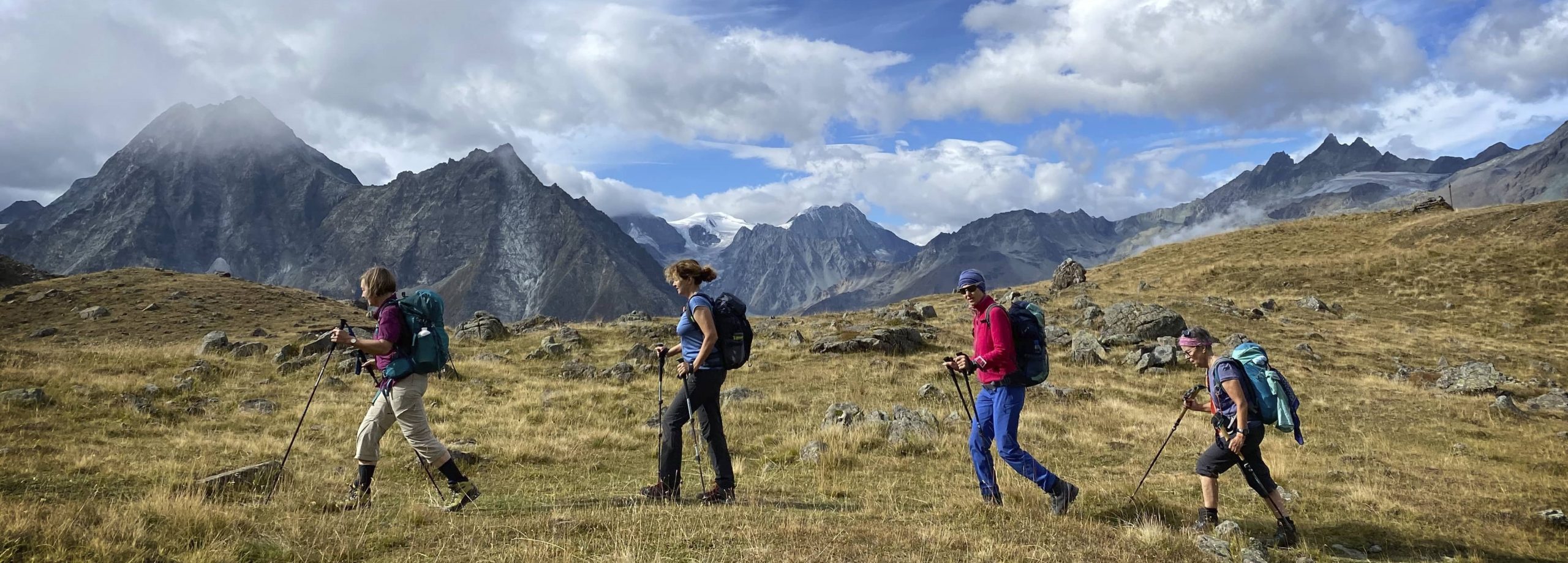
The Walker's Haute Route is the most traditional alpine trek. The British Alpine Club established the route for its members in the mid-19th century as "The High Level Route". From Mont Blanc to the Matterhorn, Walker's Haute Route connects the two mountaineering capitals of Chamonix and Zermatt over more than 200 km and eight alpine hiking passes, past imposing glaciers, turquoise-blue mountain lakes and with views of the highest mountains in the Alps. A trekking adventure then and now!
From Mont Blanc to the Matterhorn
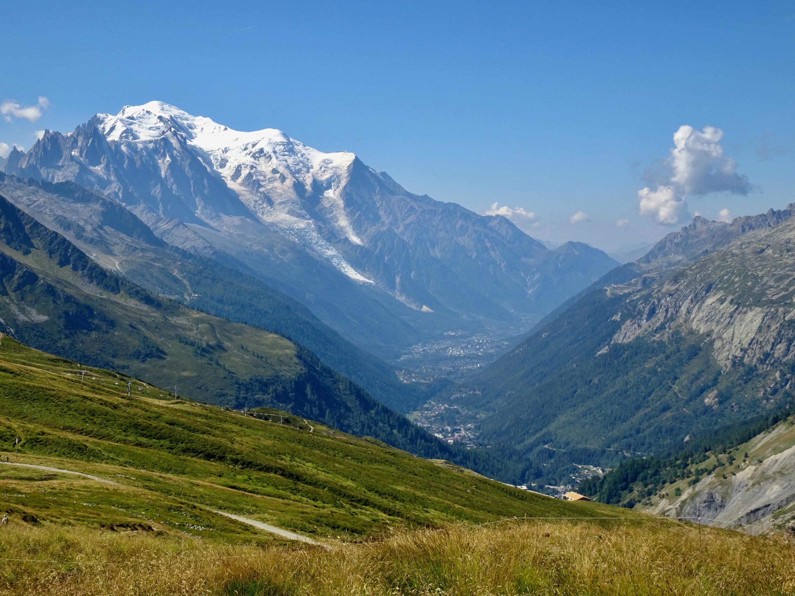
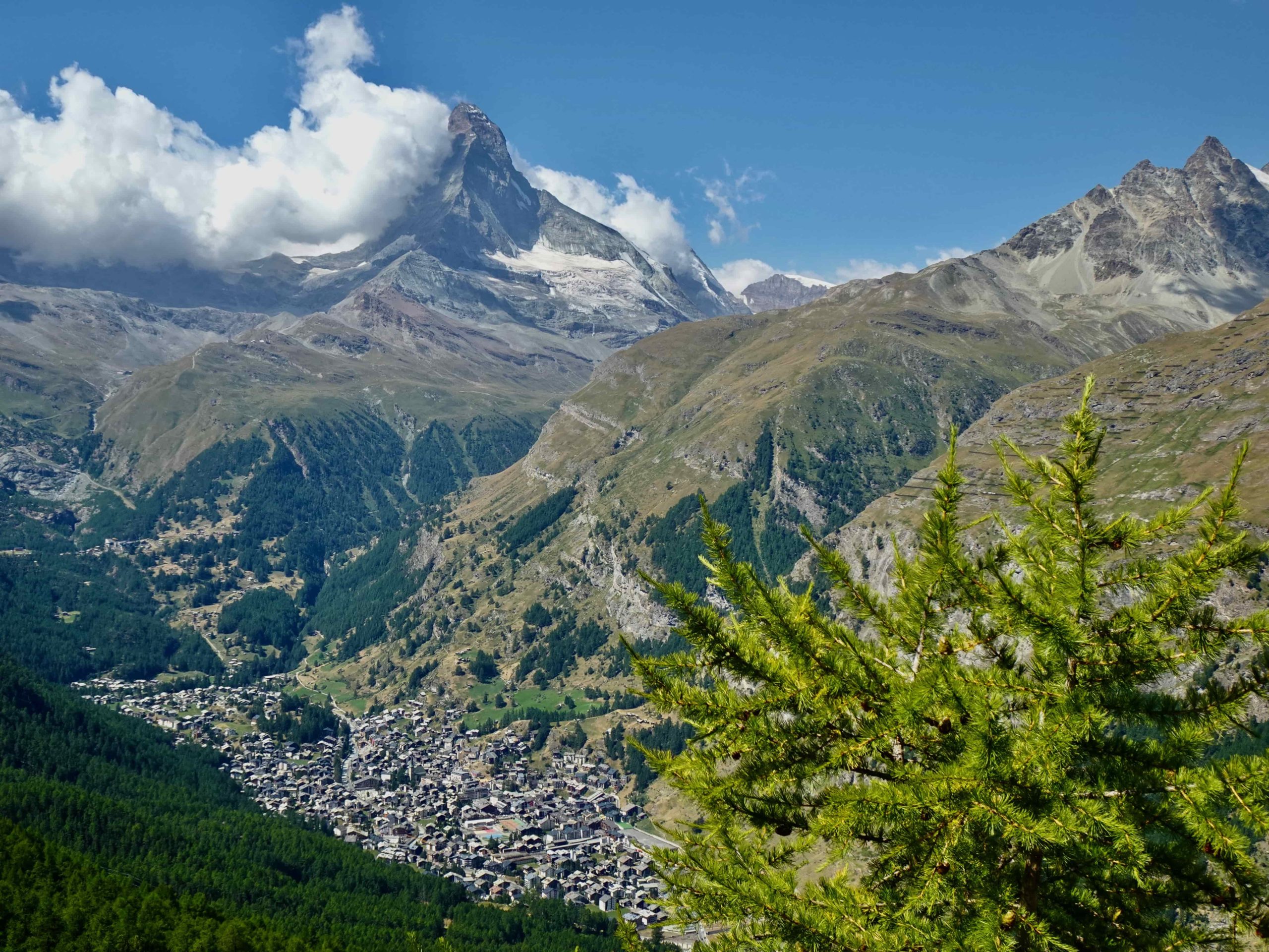
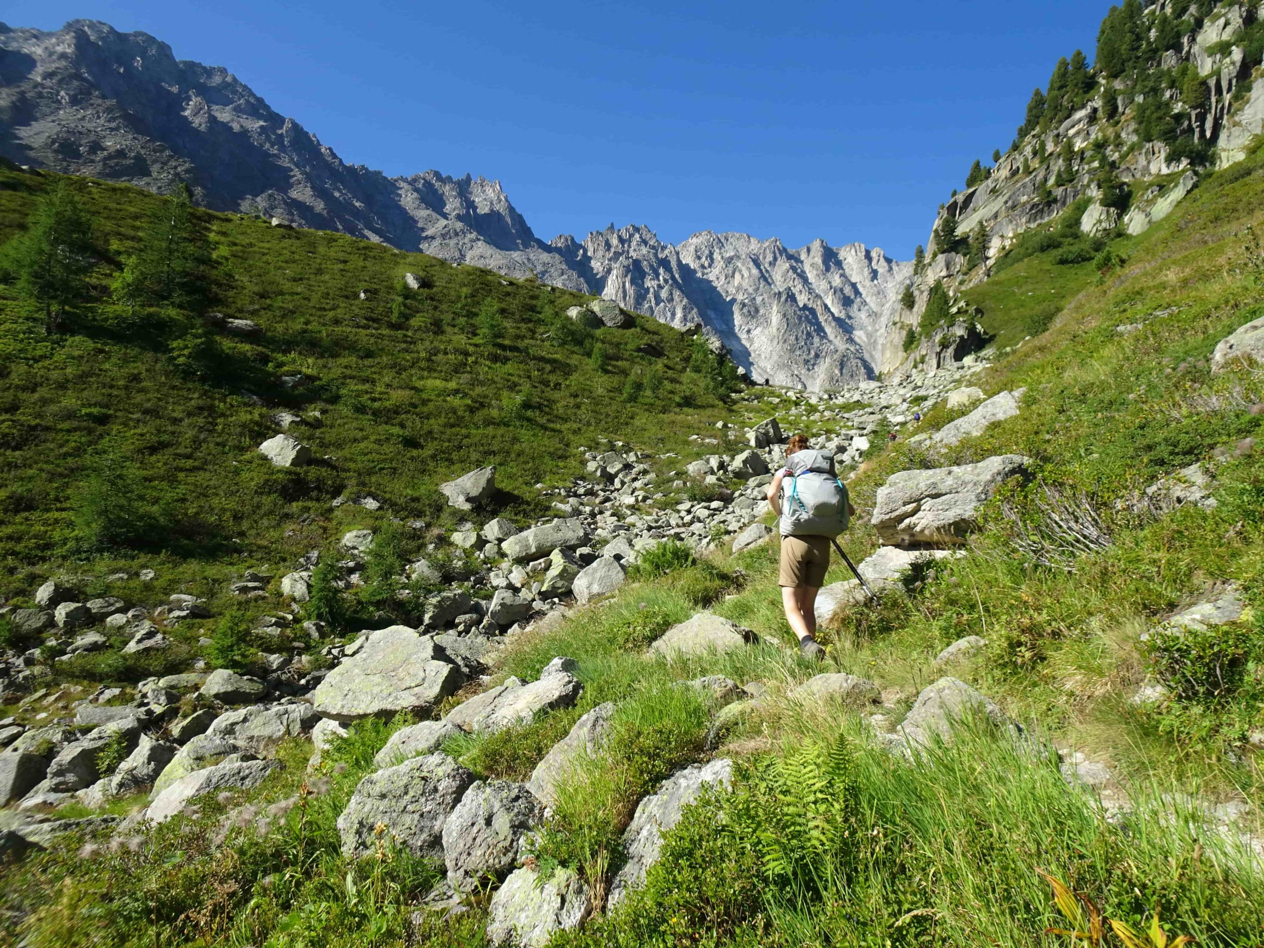
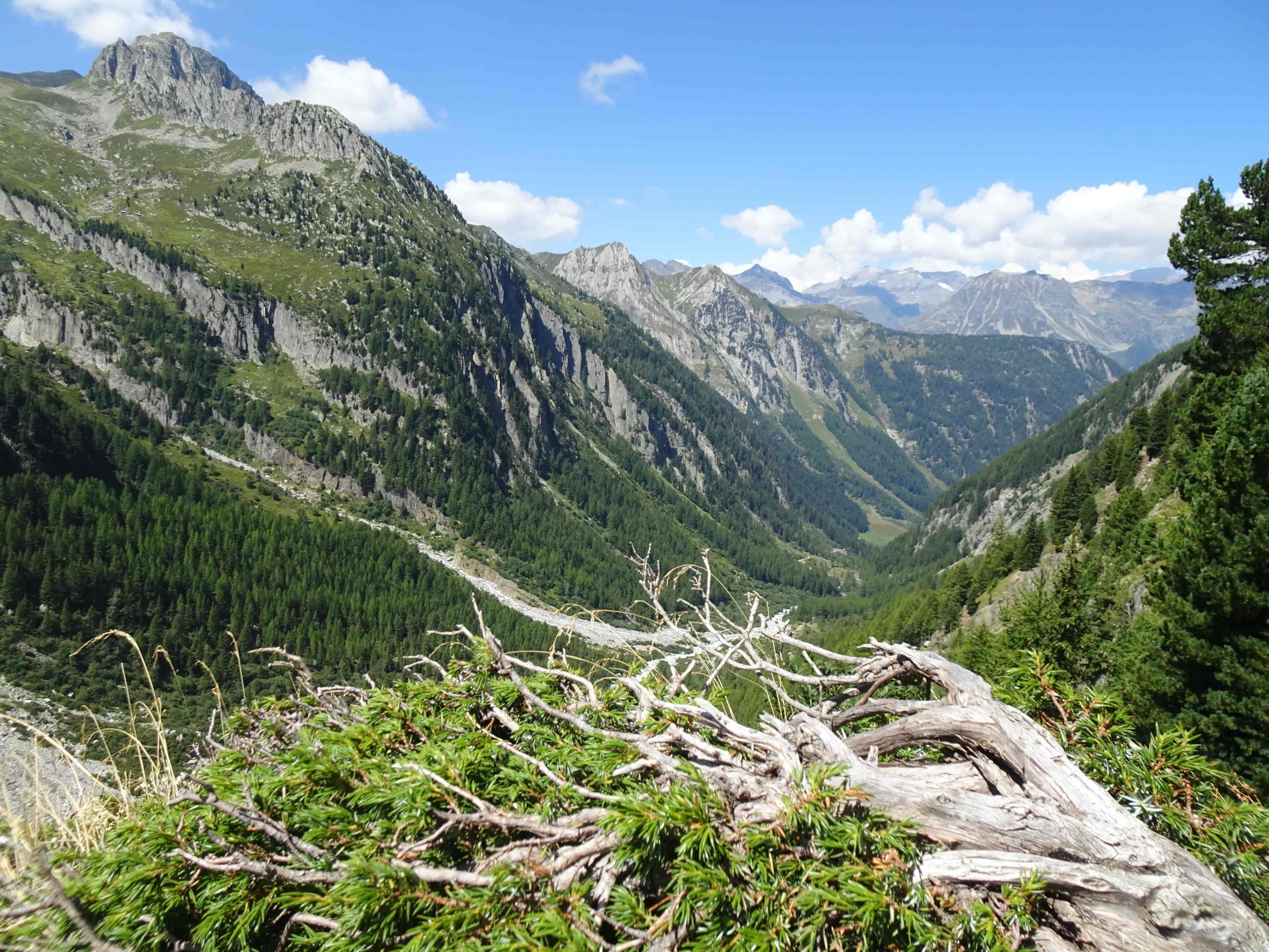
From the French mountaineering metropolis of Chamonix, the Walker's Haute Route leads across the Col de Balme and the border into Lower Valais into Switzerland against a magnificent backdrop of Mont Blanc, Aiguille du Midi and Grande Jorasses. The Fenêtre d'Arpette is a small passage before the mighty Glacier du Trient into the Val d'Entremont. From glamorous Verbier, with a view of the all-conquering Grand Combin, the route continues through the lonely stone desert of Le Grand Désert to the Col de Prafleuri (2987 m), the highest point of the route, and down to Lac des Dix. Half of the route is covered in Arolla, but with the Col de Tsaté, the Meid Pass and the Augstbord Pass, three further and no less impressive crossings with breathtaking panoramic views of the Val d'Anniviers, Turtmann and Mattertal follow. Having now arrived in German-speaking Switzerland, the route leads along the Europaweg to Zermatt with the Matterhorn firmly in view.
The route can be shortened here and there by train, bus or cable car and for most stages it is possible to hike with a light daypack and have your luggage transported from hotel to hotel.


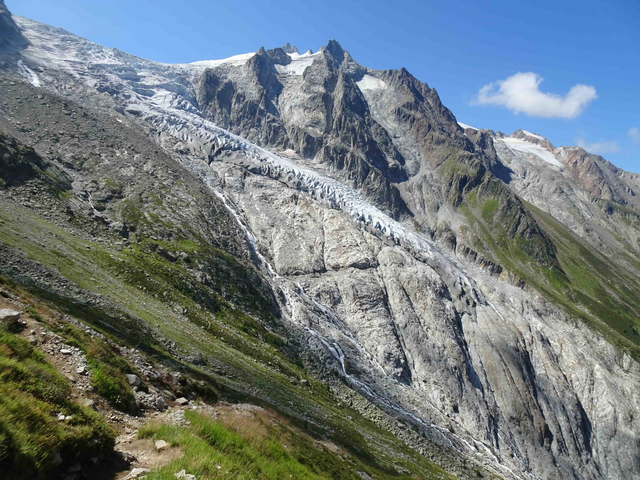
The Arpette window offers powerful views and exciting insights
Trient is a small village that lies below the Col de la Forclaz in the valley plain and is most notable for its beautiful pink church, which sits prominently on a hill. The stage through the Fenêntre d'Arpette starts either directly from the village or from the pass and initially leads leisurely along the Bisse de Trient.
As calmly as the water flows in the lateral canal, so eventful is its history. In the middle of the 19th century, Monsieur Maurice Robatel was granted permission to mine ice from the Trient glacier. Blocks of ice were blasted from the glacier using black powder. The ice was delivered to the surrounding hotels and restaurants to cool their food supplies. In 1883, Monsieur Maurice Robatel joined forces with his brother-in-law Monsieur Claudius Bompard. Together they built a route and a Decauville track from the Col de la Forclaz to the glacier. This made it possible to significantly increase the capacity of mining and transportation. Now 20 to 30,000 kg of ice could be delivered daily to Martigny and from there on to Paris. However, the Decauville track proved to be too weak and operations had to be discontinued around 10 years later. Only then was a bisse built parallel to the track to channel the water from the glacier to the meadows and crops of Martigny for irrigation.
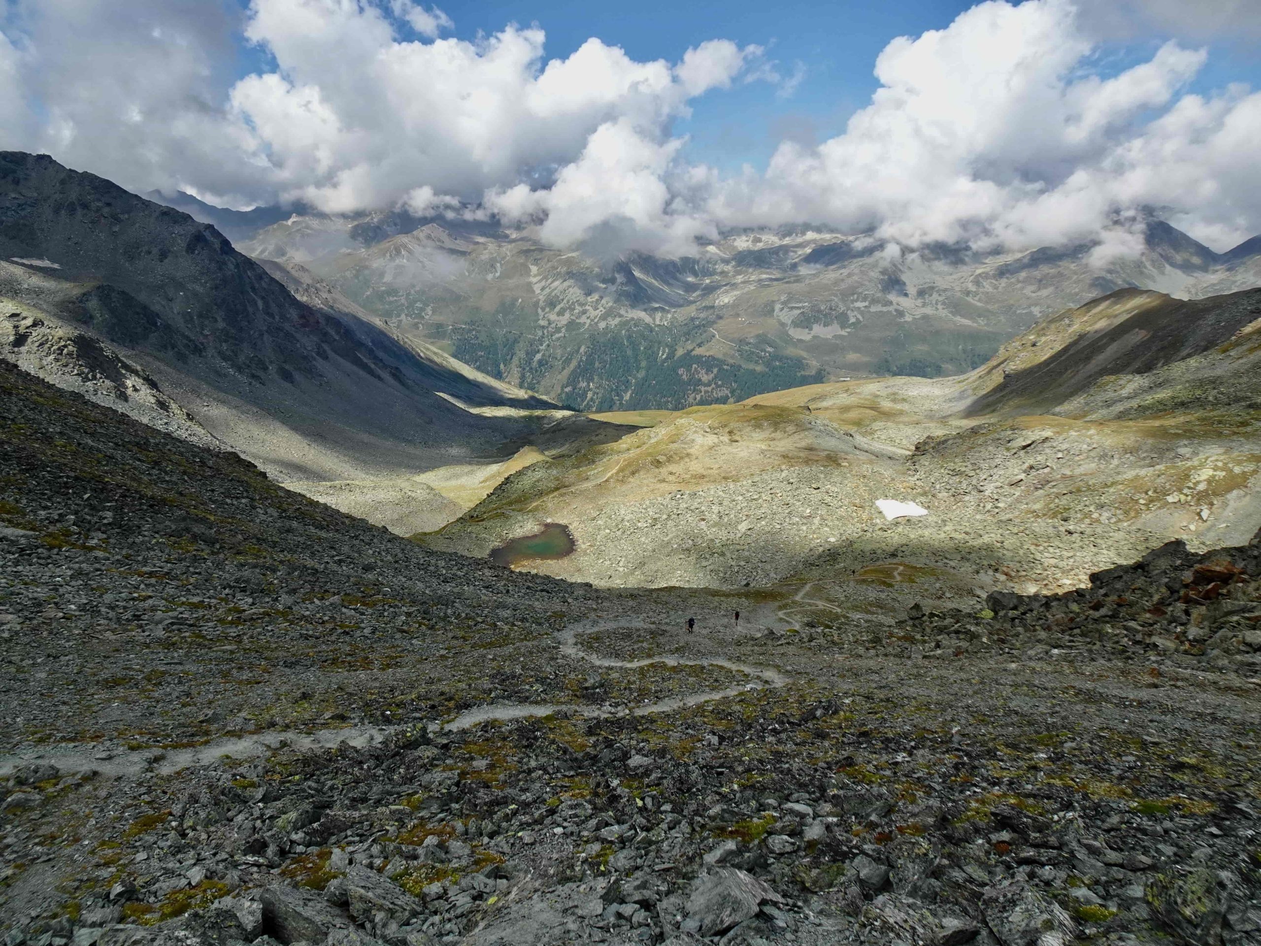
You have now reached the Buvette Glacier du Trient. Here, where the bisse branches off, considerably more water disappears into the mountain and is fed into Lac d'Emosson. And now the " warm-up" is over. The path climbs and climbs until the highest point, the Fenêtre d'Arpette, can be glimpsed. But the view of the wildly carved Trient glacier makes up for the effort. And then you reach the pass and it is almost as if you are passing through a window into the next valley. It is a small gap between the rocks at 2665 m that connects Trient with the lovely Val d'Arpette and Champex-Lac. Here in Champex there is time to stretch your tired legs and refresh yourself with a cool drink or a dip in the lake.
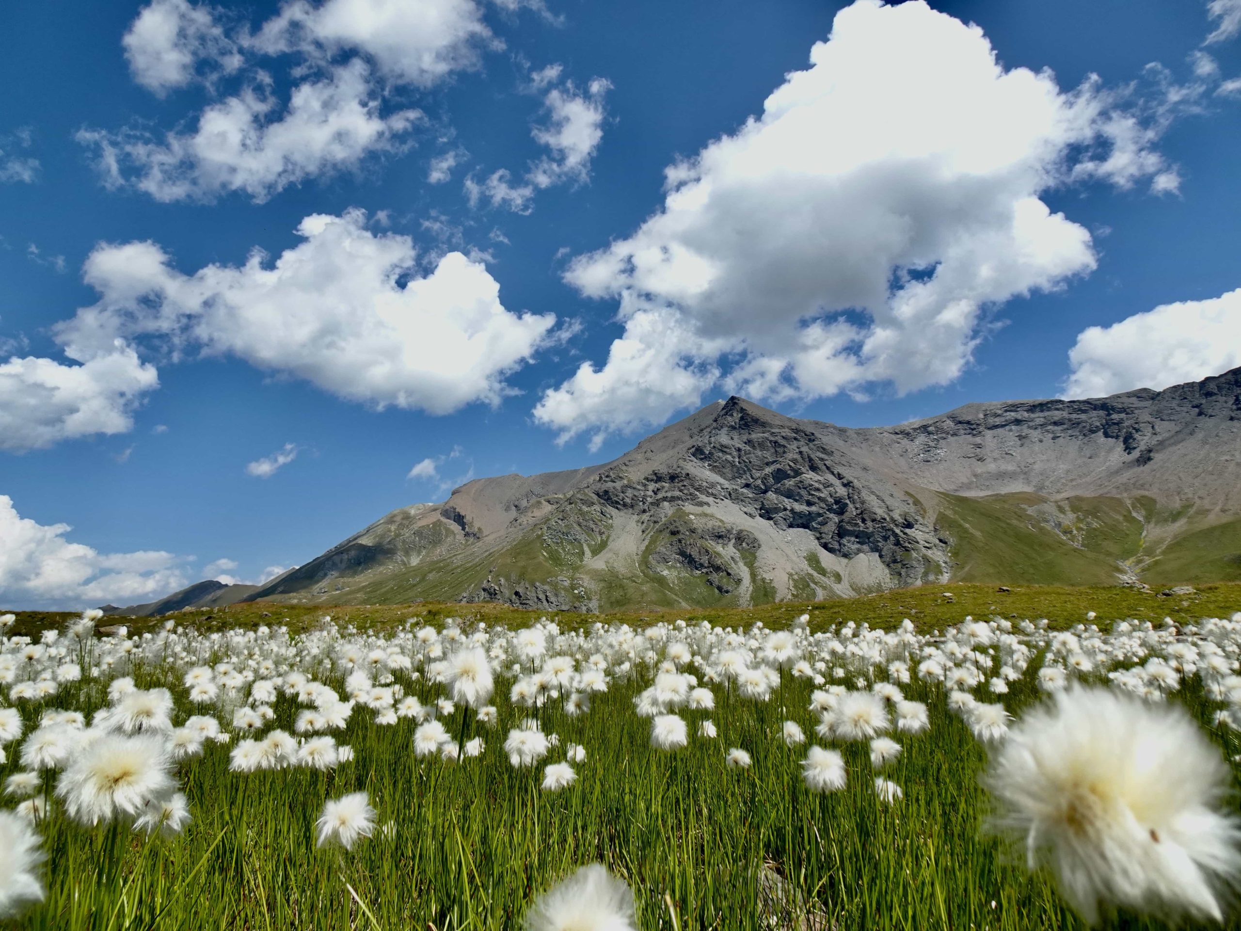
Le Grand Désert
When you think of deserts, the first thing that comes to mind is probably images of endless sand dunes. But deserts come in a wide variety of forms: from sand to gravel, stone, salt or ice deserts, from cold to warm. By definition, a desert is a place that has no or very little vegetation. Lack of water or lack of heat are the causes of desert areas. By far the largest desert is the Antarctica, followed by the Sahara and the Gobi Desert. To speak of deserts in Switzerland is probably rather surprising. But they do exist.
Between the Val de Bagnes and Val d'Hérémence, hidden behind the Mont Fort and the Rosablanche and high above Verbier and Nendaz lies Le Grand Désert. One of the loneliest stages of the Walker's Haute Route leads right through this remote area. The impressive Grand Désert, the Great Desert, is reached via the Col de Louvie. It used to be a sheet of ice that stretched from Rosablanche to Mont Fort and far to the north. Today, the glacier has retreated to an altitude of 2900 meters. A rocky desert has been left in front of the ice sheet, with small, shimmering green-blue glacial lakes here and there. The trail winds its way through this barren moraine landscape up to the Col de Prafleuri (2987 m), the highest point of the Walker's Haute Route. Once again, the view glides back over the inhospitable but fascinating plateau, where only a few undemanding pioneer plants have been able to colonize to this day.

The Augstbord Pass and the muleteers
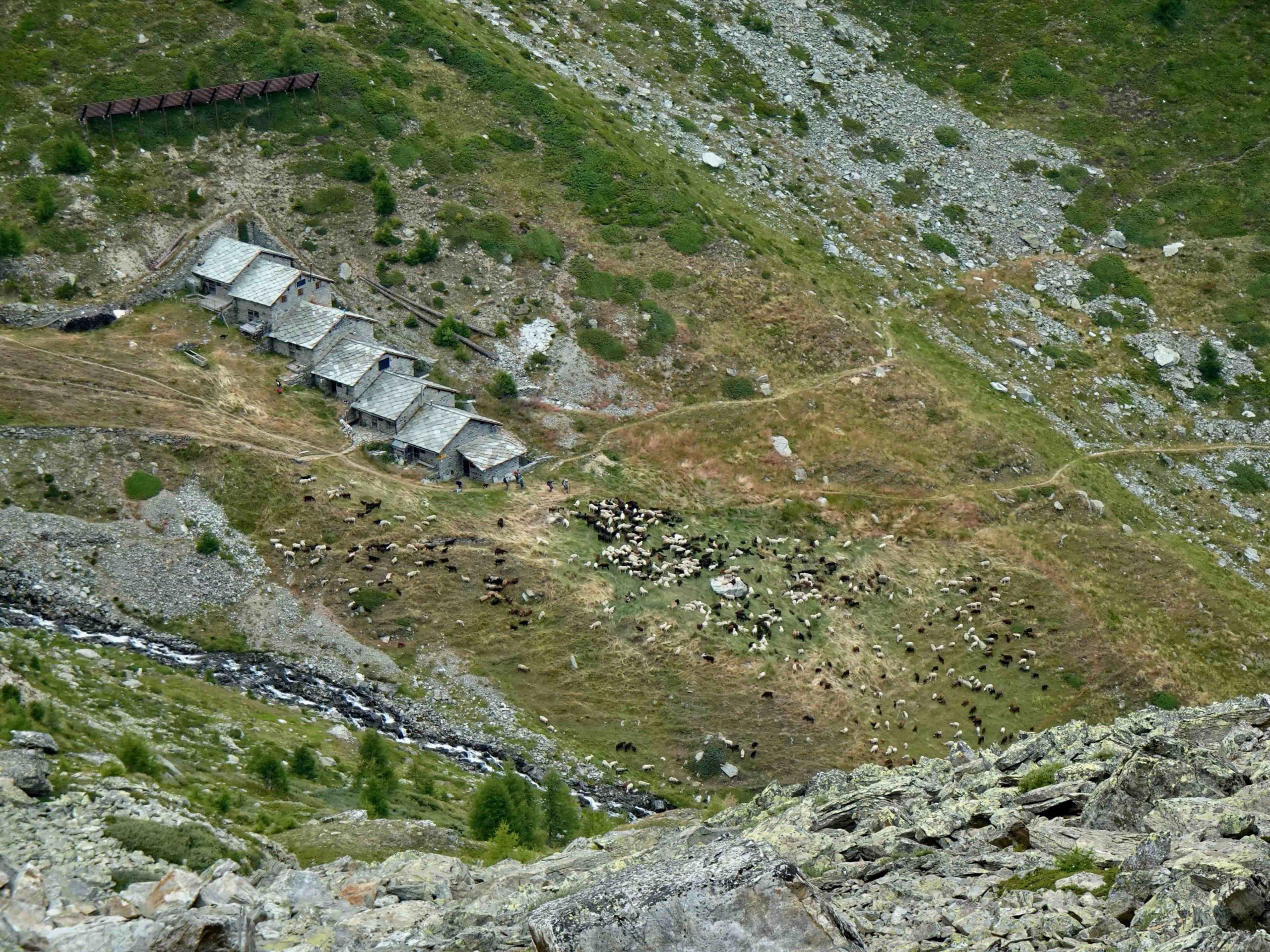
Gruben at the very back of the Turtmann valley marks the language border. Whether hotel, restaurant or hiking trail sign, German is now spoken. The trail leads up from the hamlet, through sparse larch forests, across wide alpine meadows and ever higher into a barren world of stone. Now you are accompanied only by the wind and bead after bead of sweat drips from your forehead until you reach the Augstbord Pass (2892 m) at almost 2900 meters. The ascent must have been very similar for muleteers and pilgrims in times gone by. The only difference is that for us, the effort is an active recovery and once we reach the top we enjoy the peace and solitude and the magnificent view. Historically, the crossing was already important in the Middle Ages and probably much earlier. For muleteers and pilgrims, the connection from the Aosta Valley over the Theodul Pass to Zermatt in Valais was the most direct route. Depending on the destination, the route fanned out in the Mattertal and led either out of the valley into central Valais or Goms or over the Augstbord Pass into Lower Valais and the Bernese Oberland. It's easy to imagine that this way of traveling was exhausting back then. This makes the descent through the steep Augstbortälli with a light hiking rucksack all the more pleasant. The Schafalp Augstbordstaffel clings to the slope opposite and the view of the mighty Mischabel group with the Dom and Nadelhorn is impressive, almost "Nepalese".
And even though the Walker's Haute Route was invented by the English, the crossings from valley to valley were already known and used much earlier. This is also evidenced by finds of pieces of wood from the Le Grand Désert area, which are 3500 years old and therefore belong to the late Bronze Age.
More alpine Trekkings of Switzerland
Switzerland, with its breathtaking alpine landscape, is a hiking paradise for nature lovers and outdoor enthusiasts. The variety of hiking trails in Switzerland offers almost endless hiking opportunities.
The Via Alpina and the Four Springs Trail are particularly beautiful hiking routes.